
Northeast Drought Update
Posted October 15, 2026
U.S. Drought Monitor
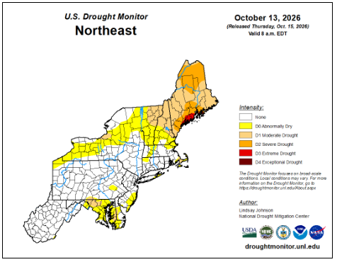
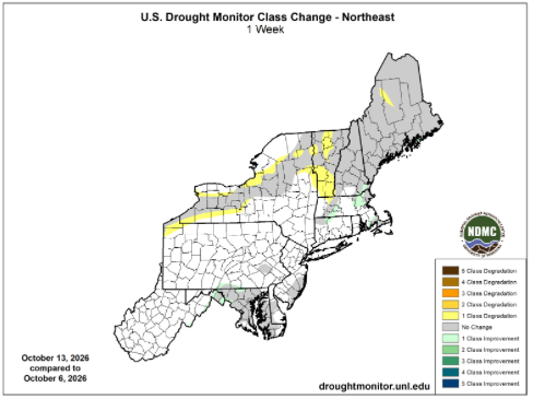
Conditions deteriorated in northern areas of the region, while recent rain allowed some improvement in southern areas. Severe drought expanded in Maine; moderate drought expanded in Vermont and was introduced in central New York; abnormally dry conditions expanded in areas across New York and in southern Vermont. Moderate drought and abnormally dry conditions improved in Massachusetts, Connecticut, and Rhode Island, as well as in small areas of southcentral Pennsylvania, eastern West Virginia, and western Maryland. The U.S. Drought Monitor released on October 15 showed 1% of the Northeast in extreme drought, 7% in severe drought, 14% in moderate drought, and 21% as abnormally dry compared to 1%, 7%, 14%, and 18%, respectively, last week. Noticing impacts from dry conditions in your area? Reports can be submitted online via the Condition Monitoring Observation Reports (CMOR) website.
For more information on drought in NY & New England see the Northeast DEWS Dashboard and to learn more about assessing drought in the United States watch this video.
Precipitation
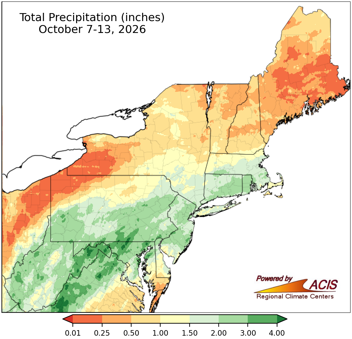
Total precipitation for the last week.
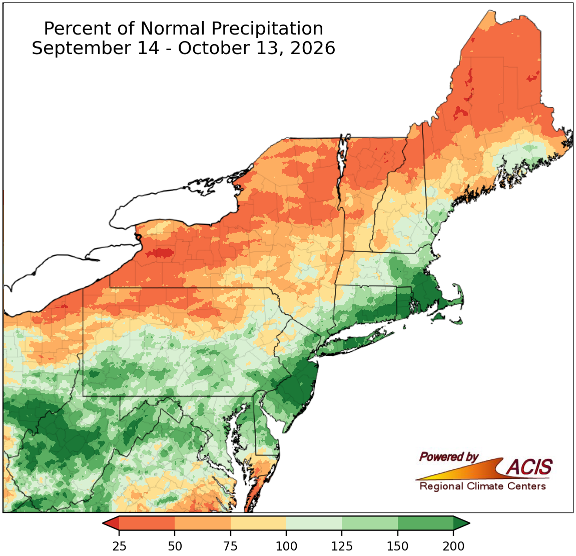
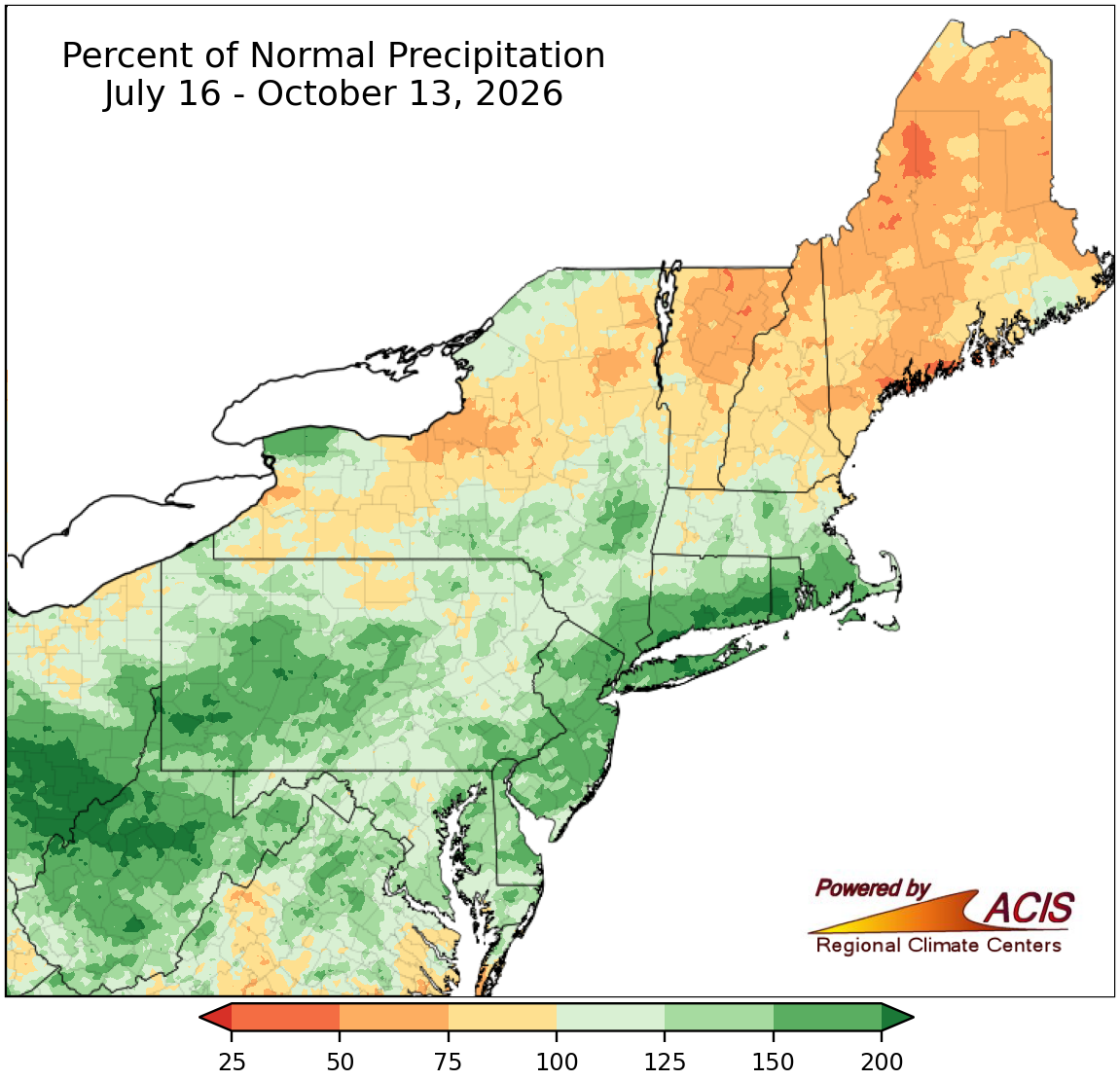
Percent of normal precipitation for the last 30-day and 90-day periods.
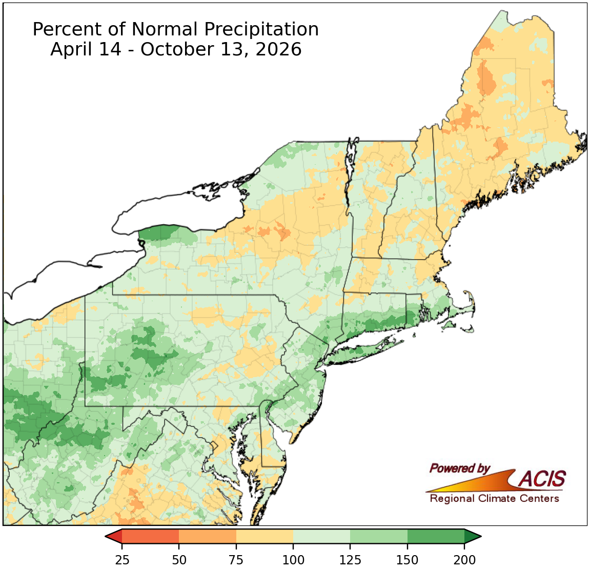
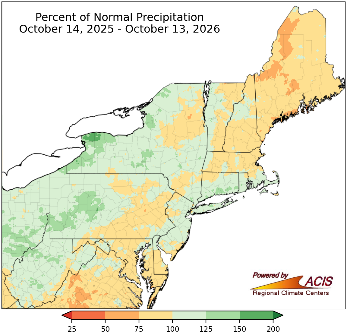
Percent of normal precipitation for the last 6-month and 1-year periods.
Water Resources
As of October 13, USGS 7-day streamflow ranged from record low in places like Maine, northern Vermont, and northern New York to record high in locations such as central West Virginia, southwestern Pennsylvania, and southern Rhode Island. USGS groundwater levels as of October 13 ranged from record low in several areas including southern Maine, southeastern Massachusetts, southeastern New Jersey, and southern Maryland to record high in spots like northern West Virginia, western Pennsylvania, and northeastern New Jersey. There have been several reports of dry wells in Maine. In early October, Baltimore, MD, began incorporating water from its backup source, the Susquehanna River, into its water supply as the water level in one of its reservoirs fell to its lowest level in 20 years. Water conservation continued to be encouraged in multiple locations, with some communities like Kittery, ME, having mandatory water restrictions.
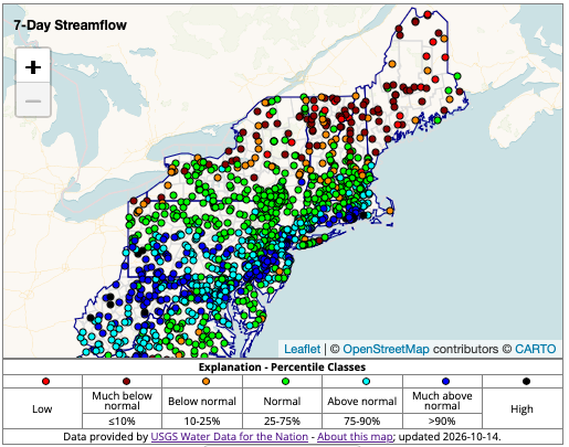
7-day average streamflow compared to historical streamflow from USGS WaterWatch
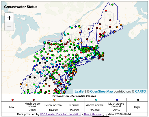
A network of wells to monitor the effects of droughts & other climate variability on groundwater levels. USGS Groundwater Data
State Declarations

Outlooks
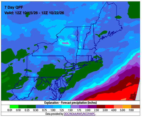
Seven-day precipitation amounts are forecast to range from a tenth of an inch to one and a half inches. A cold front is expected to bring precipitation to the region Thursday through Saturday, followed by much cooler temperatures. After the frontal passage, the remainder of the forecast period is mostly dry.
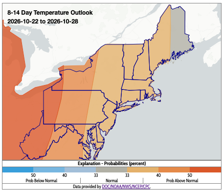
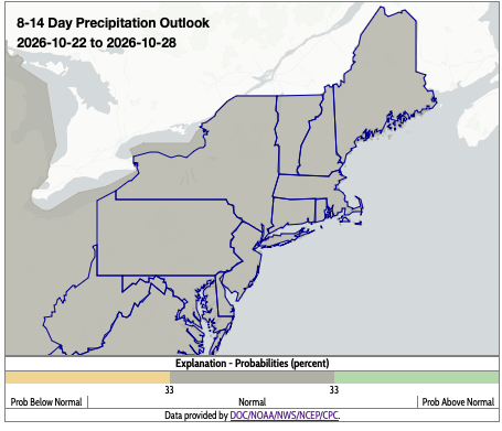
NOAA’s Climate Prediction Center (CPC) 8-14 day outlook for October 22-28 favors near- to above-normal temperatures with probabilities increasing westward. The outlook favors near-normal precipitation for the entire region.
The maps on this page, and additional drought resources, can also be found on the Northeast DEWS Dashboard.
About Northeast Drought
This page offers drought information by state, with links to regional and national drought web pages.